


le Vaudoue eglise

SUPERMAMINOU2004
User

Length
10.4 km

Max alt
130 m

Uphill gradient
140 m
Km-Effort
12.2 km

Min alt
69 m

Downhill gradient
140 m
Boucle
Yes
Creation date :
2021-12-06 08:58:46.163
Updated on :
2021-12-06 11:36:30.04
2h33
Difficulty : Difficult

FREE GPS app for hiking
 SityTrail
IGN / Geographical institutes
SityTrail Plus
The world is yours!
About
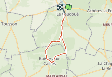
Trail Walking of 10.4 km to be discovered at Ile-de-France, Seine-et-Marne, Le Vaudoué. This trail is proposed by SUPERMAMINOU2004.
Positioning
Country:
France
Region :
Ile-de-France
Department/Province :
Seine-et-Marne
Municipality :
Le Vaudoué
Location:
Unknown
Start:(Dec)
Start:(UTM)
464320 ; 5355854 (31U) N.
Comments